Improve Wildfire Recovery in National Parks & Beyond
Pilot testing a tool in Joshua Tree National Park and the Mojave National Reserve that allows land managers to rapidly assess and respond to wildfires
The Problem
Wildfires are some of the greatest threats to species and ecosystems nationwide that depend on millions of acres of lands for critical habitat refuge. These same places also act as vital carbon sinks. Agencies like the National Park Service (NPS) face grave challenges in addressing wildfires from climate change to resource limitations. While fire prevention and preparedness typically receive more attention, fewer efforts are dedicated to recovery: specifically, how to manage landscapes in time-sensitive periods after a fire.
The Opportunity
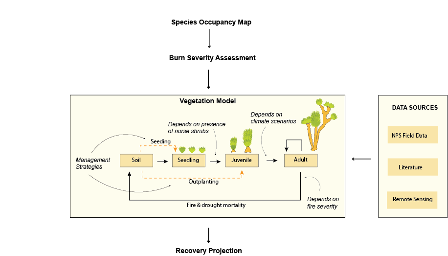
Schmidt DSE is partnering with NPS to develop a first-of-its-kind suite of tools to help land managers make quick and informed decisions that support post-fire recovery in drylands and arid ecosystems. We are using both observed and modeled data in order to help scale recovery efforts in the face of an ever-changing climate and across the immense diversity of US landscapes. As a testament to the value of this collaboration, the NPS has directly invested in Schmidt DSE’s research on this project.
Key Highlights
- Piloting a disturbance response tool in Joshua Tree National Park and the Mojave National Reserve that allows land managers to rapidly assess and respond to wildfires.
- Prototyping software utilities to help facilitate vegetation modeling that support the disturbance response toolkit.
- The National Park Service is contributing funds to this project in recognition of DSE's impact.
Our Impact
Our tool uses satellite imagery to rapidly assess fire boundaries and appropriately tunes the severity assessment for the local desert ecosystem. This allows land managers to make quicker management decisions and deploy limited resources more efficiently. In the future and with additional development, the tool will include desert-specific data, data from other ecosystems, incorporate observed data collected by NPS and other entities, and communicate wildfire severity in other types of landscapes that are newly fire-prone.
Future Vision
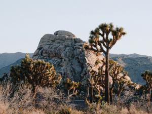
While our pilot project is focused on Joshua Trees in Joshua Tree National Park, we are designing and engineering flexible modeling tools that can scale across ecosystems. This may include chaparral shrublands, sagebrush habitat, and Whitebark pine forest habitats. Each of these ecosystems face novel management challenges under the effects of climate change. Ultimately, we aim for the tool to cover a large latitudinal gradient of ecosystems that vary in both water limitation and proneness to fire (and are expected to continue changing due to climate instability). We also hope to expand the tool usage for more public agencies and Tribal nations.
This spring we are planning a fire recovery workshop to help showcase the tool to NPS staff and interagency collaborators.
Partner Feedback
“Historically, fire severity and fire risk tools have not worked well in desert ecosystems because these tools are usually developed for forests, where plant productivity, biomass, and density are much higher. DSE’s work is very helpful to fire and resource managers working in the desert because it’s specifically tailored to those landscapes.”
- Jay Goodwin, former Vegetation Branch Chief at Joshua Tree National Park