Exploring Wildfire Data and Tooling
PILOT PROJECT: Historical analysis and tool for studying Cal Fires Boundary Data
The impacts of climate change are fueling an alarming rise in the scale and frequency of wildfires. At DSE, we are interested in understanding the data and software infrastructure that researchers use to access open fire data and tooling.
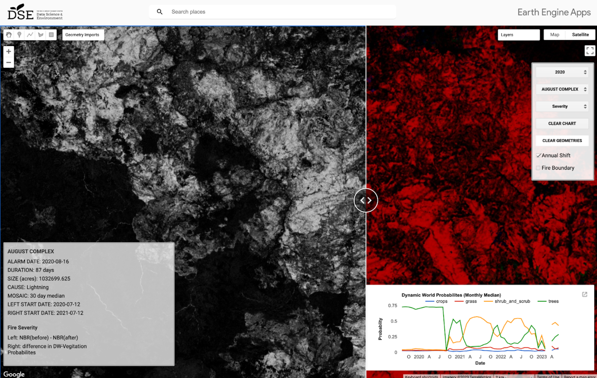
To initiate our exploration in this realm, DSE has developed an Earth Engine App, enabling users to visualize the severity and consequences of recent large wildfires in California. In particular, it offers split-screen "Before and After Fire" views of Sentinel-2, Sentinel-1, Landuse from Dynamic World (DW) and Normalized Burn Ratio (NBR). Moreover, the user can draw polygons and see charts showing the change in Dynamic World Vegetation probabilities over time. The sharp drop, and slow return of the vegetation shows not only the immediate effects of the fire but also the rate of recovery. The app also offers an additional split-screen view displaying two different measures of fire severity. This prototype tool has been developed in an effort to continue dialog to access and distill insights from open data and satellite imagery.
Wildfires remain one of the most pressing environmental challenges facing the world at the moment and DSE is still actively looking for collaborations to apply our expertise. We are especially interested in projects that leverage satellite imagery machine learning in novel ways to deepen our understanding of the wildland urban interface. We are also interested in the development of open data and open software for ecological, policy, and/or biological researchers. If you are working on a project in this space, reach out!
Type
DSE Contributors
Brookie Guzder-Williams